
GIS Applications for Social and Behavior Change Communication in Liberia’s Ebola Response
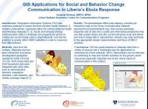
Data from the multiple, disparate sources were interwoven to produce an integrated geospatial dataset for Liberia using a special GIS software package. WHO Ebola data and DHS household data were integrated with other data, such as administrative divisions, population densities, road networks, and mobile coverage maps
The geodatabase offers map displays, including an interactive map on the Ebola Communication Network, that overlay seemingly disparate sets of data into a useful and informative perspective that can help explain where and why current behaviors exist and where and how to target SBCC interventions. Results may help contribute to the appropriate design implementation and focus of SBCC activities.
GIS has great potential to integrate data from a variety of sources into a meaningful way for applications in controling the Ebola outbreak. SBCC interventions can be informed by continuing to map and monitor activities on the ground, which may prove especially important due to the critical nature of communication in this context.
Source: Johns Hopkins University Center for Communicaiton Programs
Date of Publication: October 15, 2021
SIMILIAR RESOURCES
Tools
Examples
- Crisis and Outbreak Communication Pandemic Flu and Other Disasters
- Behavioral Design for COVID-19 Response
- Behavioral Science Tips for Physical Distancing
- A Guide to WHO’s Guidance on COVID-19
- Love, Children and Family Planning: Seven Discussion Guides for Christian Small Groups
- Compassion in a Time of COVID-19
- Practical Guidance for Risk Communication and Community Engagement (RCCE) for Refugees, Internally Displaced Persons (IDPs), Migrants, and Host Communities Particularly Vulnerable to COVID-19 Pandemic
- Religious Leaders Play Key Role in Battle against COVID-19
- COVID-19 and Child, Early, and Forced Marriage: An Agenda for Action